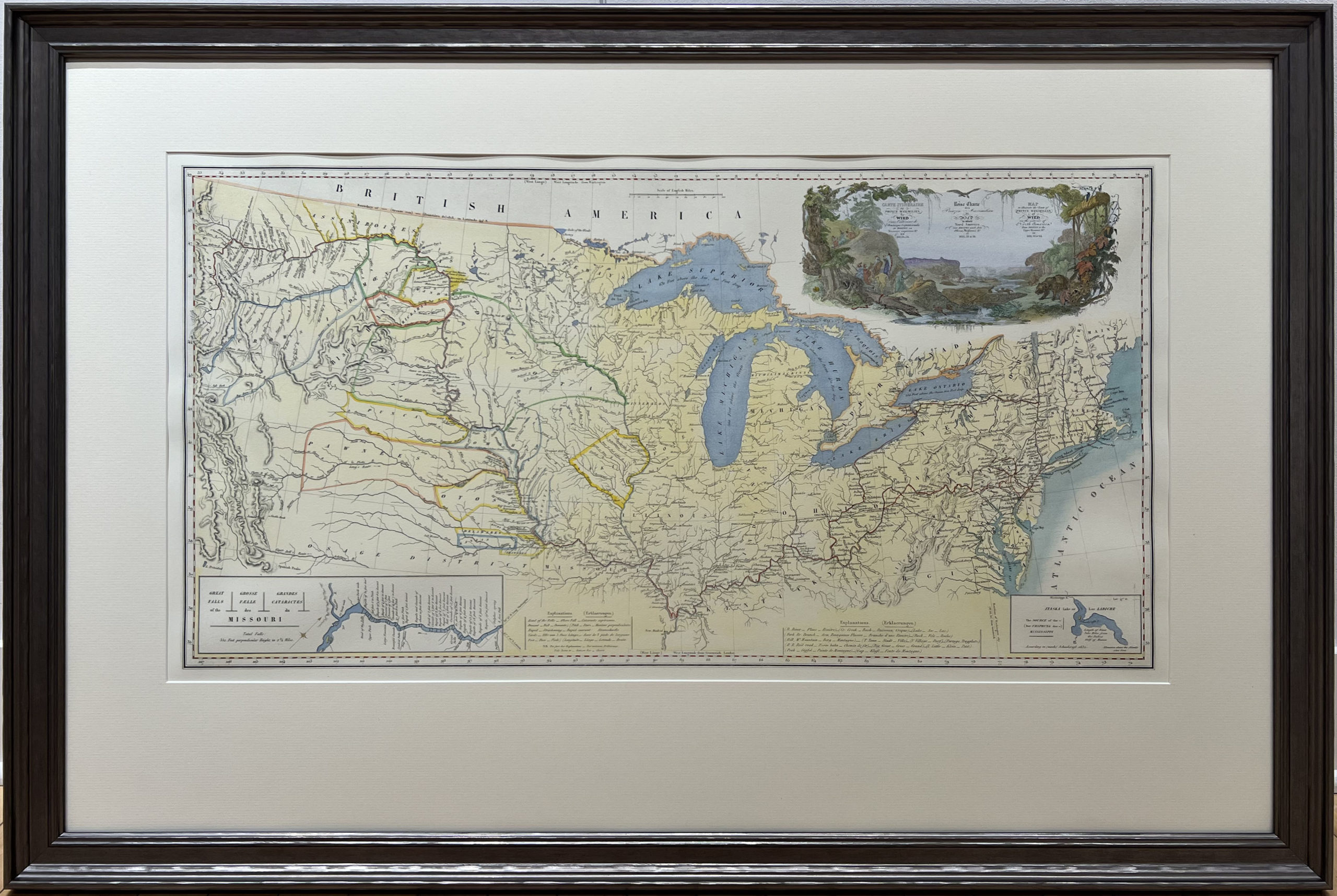


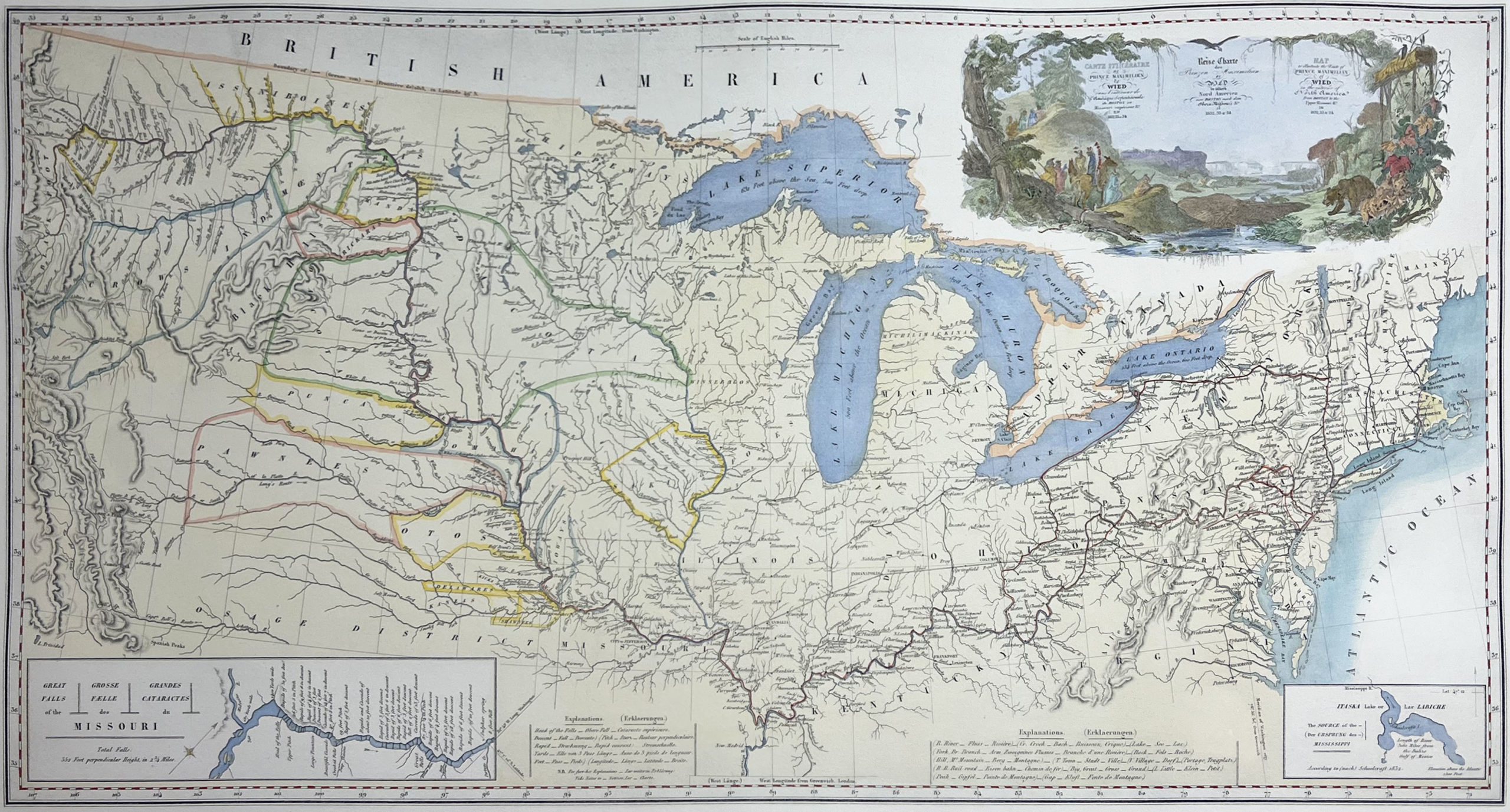
The Clark-Maximillian Map Drawings
From the permanent collection of the Joslyn Art Museum, Omaha, Nebraska.
During his 1832-1834 expedition of North America, entries from scientific journals of Prince Maximilian of Wied-Neuwied (1782-1867) dating to March 24-April 10, 1833, describe his stay in St. Louis, Missouri. The Prince had met a number of individuals during this time period that proved quite helpful to his plans for further travel into the middle and northwestern regions of the North American continent. Among them was explorer William Clark, who was then serving as superintendent of Indian affairs for western tribes.
He also met with Kenneth McKenzie, principal shareholder in the Northwest Fur Company, and Pierre Chouteau of the American Fur Company. And, at the house of Major Benjamin O’Fallon (William Clark’s nephew), he inspected a collection of Indian portraits painted by George Catlin, who the year before had visited trading posts along the Missouri River. It was during this stop in St. Louis that Major O’Fallon provided hand-drawn copies of maps depicting the Missouri River regions known to Lewis & Clark during that part of their 1804-1806 expedition.
To complement the bi-centenary celebrations of the Lewis & Clark expedition, a limited edition of 200 collector sets of these fine facscimile prints (measuring 16 x 20 inches) has been prepared by Alecto Historical Editions, London.